Soil moisture identification with drones demonstrated by Virginia Tech students
Three Virginia Tech University seniors researched how drones could identify soil moisture for a class project.
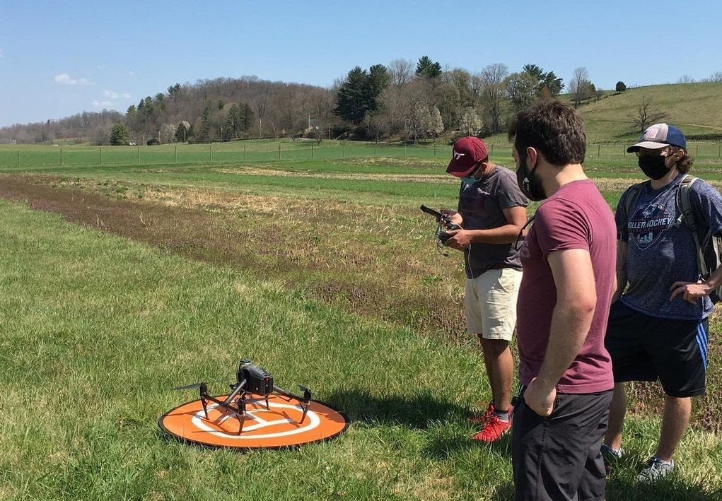
Matt Darrah, Grady Hesse, and Ryan Humphry of the School of Plant and Environmental Sciences were introduced to precision agriculture as a management practice where autonomous survey devices are sent out to collect land and soil samples to routinely identify areas that need supplemental nutrients.
They wondered if this could be replicated with a drone.
“That could be groundbreaking,” said Darrah, a Las Vegas resident and an environmental science graduate. “On top of it being cool to fly drones, we thought we could partake in potentially revolutionary research as undergraduates.”
The study investigated Soil Adjusted Vegetation Index (SAVI) and Normalized Difference Vegetation Index (NDVI) data, two spectral indices for soil, gathered from drones to determine the moisture levels of bare soil.
This experimental learning project eventually encompassed a variety of disciplines in the College of Agriculture and Life Sciences. The faculty involved with the student project included Song Li, an associate professor in the School of Plant and Environmental Sciences who specializes in advanced genomics and sensor technologies, Sanaz Shafian, an assistant professor in the School of Plant and Environmental Sciences, Shawn Jadrnicek, the farm manager of Virginia Tech’s Homefield Farm, and Xia. Li, Shafian, and Xia are affiliated faculty with the Center for Advanced Innovation in Agriculture.
Homefield Farm, a partnership between Dining Services and the College of Agriculture and Life Sciences and the only certified organic operation owned by a university in Virginia, was the site of the students’ research. The six-acre, student-run farm is located eight miles west of the Blacksburg campus and provides about 50,000 pounds of fresh produce to dining centers and Homefield’s farm stand on campus. The farm is part of Virginia Tech’s College Farm Operation, which also includes Kentland Farm.
“With all the help of the faculty and staff involved, it made this a meaningful research project for us,” Darrah said.
The students determined that more work is needed on this front, particularly the development of proper indices for soil properties, including soil moisture. The trio found that the correlation between their NDVI and SAVI data sets was insignificant and not strong enough for reliable use.
At the end of the semester, the group — along with the other students in the course — shared these results and findings via Zoom. The group discussed their aerial images, how they correlated the results, and more.
“My favorite part of the project was when we saw our results,” said Humphry, of Yorktown, Virginia, also an environmental science graduate. “We saw that we might be right in some aspects and wrong in others. But I think it was impressive just to see what we were able to accomplish in just one semester during a pandemic.”